Tuesday, March 31, 2015

After Benson


written March 30, 2015

Arizona continues to amaze us with it's diversity in terrain. North of Phoenix,
I-17 is probably the most beautiful interstate we have driven. It climbs from 3000 feet, through 4000 and 5000 and 6000, until it finally reaches over 7000 feet. Not only does this provide exquisite views but the north and south lanes are separated from the sight of each other most of the trip which adds to the beauty because it was not planned as an interstate but the southbound lanes follow old AZ-69 and the northbound ones follow old AZ-79. The Sunset Point rest area “won” a National, Most Beautiful Rest Area contest. Who knew there was even a contest.
Sunset Point Rest Area

We settled into the Distant Drums RV Resort and watched another beautiful sunset
Our first stop was at the 3900 foot level to spend a few days in the Camp Verde area. Our campground gave us coupons totaling $30 each, to use at it's Distant Drums Casino across the street. The first night we took them up on their offer and playing “slots” for the first time ever, we used all of the $60 dollars, but we “WON” $37. I think that is the way gamblers consider their winnings!! While there we put on our “Touron” (a cross between tourist and moron) clothes with camera draped over neck, and visited the towns of Prescott, Jerome, Rimshot, Camp Verde, and Sedona. 
Prescott, pronounced Pres'kit by the locals, is considered by many to be the best preserved western town. We ate lunch at the historical Saloon (and now Restaurant), The Palace. It was first opened in 1877 and the greatest story is about it's beautiful massive carved bar. The Palace was destroyed by the large Whiskey Row Fire on July 14, 1900. The huge carved bar was reportedly carried out of the building and across the street, where the patrons sat and drank at the bar as the buildings burned. Now that's a real cowboy story! 
 
Step into The Palace.....


They are quite proud of this history

The main bar area

The infamous and beautiful carved bar

Jerome is an old mining town built into the side of a mountain with switchback streets just wide enough to navigate. It was nearly a ghost town when in the 60's young artists were drawn to it and a new life for the town began.
 
Jerome, Arizona


a tight corner in Jerome

A large piece of Azurite and Malachite, donated to the state of Arizona for display

In a mining display - a "necessary" item kept in the mines for the Miners!

 Rimshot is a sleepy little town home to Montezuma's Castle and Montezuma's Well. Nice naming, since Montezuma wasn't born for another 1,000 years and he never ventured this far north. 
 
Montezuma's Castle Cliff Dwellings


- other ruins closer to the ground at Montezuma's Castle

More Cliff Dwellings at Montezuma's Wells, on walls of a natural spring.

Some of the irrigation runs the Indians had from the natural spring to water their crops

 Oh well, makes for a great story. Camp Verde hosts Fort Verde, considered the best preserved fort from the time when we were stealing all the land from the Indians.
More Congressional Medals of Honor were awarded to Camp Verde soldiers than anywhere else.

Some of Camp Verde's housing

- a look down the porches at Camp Verde
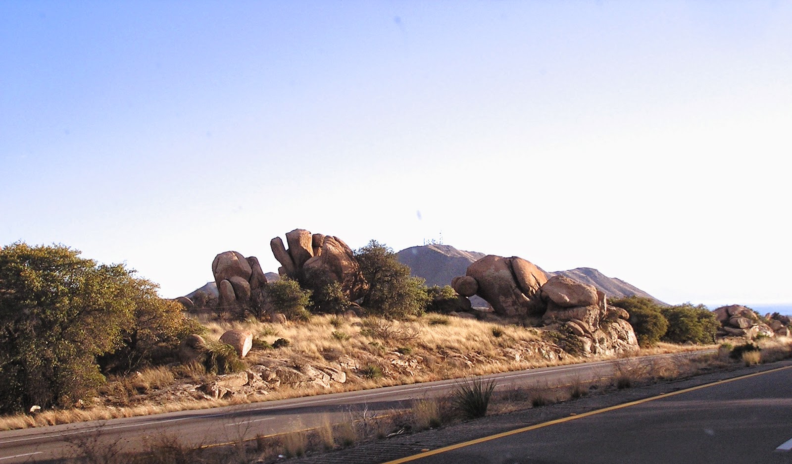
  While in the Tucson and Benson area, when asked where we were headed next we mentioned north towards the Grand Canyon. Everyone told us that we just had to see Sedona. Well, they were all right. Wow, what a gorgeous place. Incredible views wherever you look.  I looked up and saw a car driving down the side of a mountain and thought, hmm, if he could do it, so could we, so off we went in search of the road and surprisingly we found it right away. To Julie's delight it was paved, funny thing how she is appreciating pavement more and more. Anyway, since Sedona is located in canyons, the airport had to be built on a mesa on top of one of the mountains. So this road was actually the way up to the airport where the wonderful city of Sedona has provided a pullout on the town side of the mountain to obtain some incredible views of the valley. 
 
Sedona, beautiful, even on a very cloudy day.


This formation is called the Merry Go Round

The Courthouse formation

Housing goes right into the hillsides

- driving down the road from the high airport

- more ooh's and aah's
 Cool thing, while driving in Coffee Pot canyon we saw our first Javelina in the wild (actually they were in someones yard and driveway). Now all we need to see is a rattle snake and some tarantulas and our Arizona wildlife experience will be complete! (Julie says no!)  


-notice these two intruders in a yard we were driving by, Javelina

Leaving Camp Verde, Az. we once again got onto the I-17 elevator and climbed from 3900 feet through 4000, 5000, 6000, and 7000 until finally setting back “down” at 6900 in Williams, “The Gateway to the Grand Canyon”.

After our short drive to Williams, we went “downtown, where all the lights are bright”, and explored Route 66. Williams is one of a few Route 66 towns that have managed to survive the Interstate bypass phenomenon. Lots of cute businesses , and lots and lots of neon. PLUS we found the Pine Country Restaurant and Boy Howdy, do they ever have the pies!! (46 varieties) we had a slice of chocolate peanut butter that was not only 4 ½ inches high (not the highest pie in the display case) but was the second best c/p pie we have ever eaten. The best we have found is at the Mid-Point Cafe in Adrian, Texas. My mouth and fingers are watering as I type this!!!!! The restaurant is located half way from Chicago to Los Angeles on old Route 66. Pretty clever name huh? Back to Williams, Julie had her favorite peach, maybe that is why she is such a peach!!


Some of the most delicious pies ever!  High quality, and high dimensions!

The town is filed with Cafe's and stores with the Route 66 theme.
Our first foray was to head east to visit Meteor Crater. Then it was on to Petrified Forest and the Painted Desert National Parks. Meteor Crater, being privately owned made us a little leery of being nickled and dimed to death. But this could not be further from the truth. Purchasing the tickets we were given both the “geezer” discount and the AAA discount. We were approached by a young native man describing a one hour tour he was about to give describing the history and geology of the crater. When asked if we needed to purchase tickets, he said the tour was free. The crater was stunning and our guide was very well versed. Julie asked the young man if the Indian's in the area years ago considered this a sacred site.  He said, no, that they feared it and stayed away from it, thinking it was evil.  Interesting.  We left happy with a vast knowledge of the history and geology of the crater and the surrounding area.
The Meteor Crater

Ruins of a house built on the edge of the crater after it was first discovered and publicized.

A picture frame wall at the Meteor Visitor's Center where you can take a picture of the snow topped San Francisco Peaks at Flagstaff, Az. to the west.
The iconic Wigwam Motel, on Route 66 in Holbrook, Az.  We stopped by on our way to our next stops
 Although the two National Parks physically touch each other, they are totally different in what they have to offer. Petrified Rocks is a woodworkers dream that won't come true! You have all of these beautifully colored trees that you couldn't cut even with a diamond tipped saw!! Although where some of the logs have been exposed to sun and wind and rain again they are starting to deteriorate and it looks like someone has been out there with a chain saw and the wood chips have flown all over the place.
Petrified wood in the Petrified Forest National Park.  It looks so real, but is all stone!

It even looks surrounded by wood chips - but even they are of course stone.

The end of a tree stump, note the thick bark of stone.

A large tree down.  The stone breaks into sections, just from the weight of the petrified wood.
 Painted Desert is like driving into a beautiful canvas. You are completely surrounded by colors and hues that just take your breath away. On the way to the parks we got off the highway (I-40) and drove through two Route 66 towns (Winslow and Holbrook) that have not been as lucky as Williams. Most of the storefronts were empty and the houses that were still occupied were in the not so great condition. Pretty sad to see up close and personal what progress has actually cost us.
Our first views of the Painted Desert

The named Teepees formations

Newspaper Rock Petroglyphs, found in the Painted Desert

such stunning colors in the Painted Desert!
The next day we went to Grand Canyon National Park, South Rim.  OK, WOW, WOW, WOW. Julie's picture taking finger got sore! Everything you have heard about the place is correct. It just can't be real. I thought the Painted Desert was beautiful. I now have an all new meaning of the word. We left the Grand Canyon via the eastern exit, and we were presented with breath taking views of the “beginnings” of the canyon, and more of the painted desert area, this time in the Navajo Nation Reservation and not inside a National Park. 
We were blessed with a very clear day

Note the young man climbing across the rock!  Julie asks, "Does his Mother know what he is doing?!"  EEKS

Julie is holding onto the bush - not a lover of heights!

This bridge in the bottom of the Canyon spans 440 ft., carrying hikers and mules to the Phantom Ranch.

Desert View Watch Tower at the East end of Grand Canyon NP.

Jim, in the tower, looking down at Julie, looking at him.

Taken from a window inside the Tower, with the sun lowering, causing colors to deepen and shadows to grow.
  As always, this seems to be getting pretty long so will sign off for now but see ya down the road as we think our next destination will be southern Nevada.

Sunday, March 8, 2015

Cochise County

written March 8, 2015

Sabino Canyon hike

Following our two month stay in Tuscon we have headed back towards the east to the Benson Saguaro SKP Park for a couple more weeks. The park is great, and the people actually acted like they were glad we returned! We spent a week here on our way to Tucson, but due to weather and timing we were unable to experience everything that peaked our interest. So we have returned to the southeast corner of the state to explore and to enjoy the wonderful sunsets.
 
Another beautiful Arizona Sunset


ditto.....

 Now that we are in Benson, our first trip of course, was back to Tucson. We (that would be me and the new “Hat Queen of the Southwest) donned our regalia and went to Sabino Canyon in the Santa Catalina Mountains. What a spectacular Canyon. Although the altitude change of the canyon is only 550 ft. we decided to take a tram 3 ½ miles up to the head of the canyon and hike back down (good thinkin), We took a couple of side trails to get more up close and personal with Nature! The Canyon is greening up following some good rains in December and January. The wildflowers are just starting to pop. There is water in the mountain streams and pools of shallow water here and there. (I know this doesn't sound like much, but remember this is the desert) We followed our day of hiking and enjoying Sabino Canyon with a visit to El Charro (the oldest Tucson Mexican restaurant, a place Julie dined back in the 60's, in Tucson) with a gigantic YUM! We ate outside on their colorful patio and enjoyed every bite.
Saguaro's on a Sabino Canyon hillside

Sabino Canyon

One of many water filled ponds along Sabino Canyon

One of many low bridges crossing Sabino Creek

slow moving water today over the bridge....

Looking down on mortar holes worn into the rocks along the mountain stream where Native Americans ground corn/seeds.

beautiful Sabino Canyon

El Charro Restaurant, entrance to Patio area


El Charro''s outside patio


 It has been great experiencing Julie's remembrances of her previous time here in Tucson (late 60's and early 70's). Driving around seeing the changes, climbing “A” Mountain, De Grazia's, finding that where she lived back then has been bulldozed and turned into a housing complex, learning her favorite tortilla place is gone, and now having to take a tram to the top of Sabino Canyon instead of being allowed to drive our own vehicle. She is handling “change is a good thing” well, and speaking of back in the 60's, so far having “the Old Girl” around has been a very good thing!

We took a day to go to Chiricahua National Monument southeast of Benson near the New Mexico border. The roads in this part of Arizona are few and far between, so to go east we had to take I-10 passing through Texas Canyon, breathtaking piles of enormous rocks spewed from a volcano a long long time ago. It is extremely difficult to keep your eyes and thoughts on driving when surrounded by such natural beauty. 
I-10  driving through Texas Canyon, between Benson and Willcox, Arizona


Next up the road was Willcox, the home of Rex Allen, “The Arizona Cowboy”, and a wonderful small museum devoted to him. He was one of the four singing cowboys along with Gene Autry, Roy Rogers, and Tex Ritter. You could always recognize them – cause they were the ones in the WHITE HATS!! While in Willcox we just had to have lunch in a converted railroad car for some really great BBQ and then we took the “Roller Coaster Highway” south out of Willcox to the Chiricahua National Monument through some incredible countryside. 
Rex Allen Monument in Willcox, Arizona

Mural

Some of Rex Allen's costumes in the Rex Allen Museum.


some of their numerous original movie posters
 

Entering Chiricahua National Monument we were greeted by a band (eight - Mom, Pop, and the Kiddies) of coatimundi crossing the road, taking their own sweet time chasing each other in circles and chittering at each other. Quite a pleasant surprise. Coatimundi are South American mammals that have migrated north and are related to raccoons and look like a cross between the raccoon and an anteater. The Park surprised us with some of the most unusual rock formations we have thus far seen on our voyage. We hiked a couple of trails in, over, around, and through the formations for even more spectacular views.
Chiricahua National Monument, Arizona

beautiful rock formations

The coatimundi were playing on and crossing the road  as they chattered away......what a delightful surprise!

so many balancing rocks


The farthest ridge is called Cochise's Head, for obvious reasons.

These rock formations look like armies of marching men


Jim named this one a dog with a back pack - I like it!

a balancing Dove perhaps..

just .... WOW!...this was over our heads alongside the trail we were on


How are some of these holding on?

Jim and I named this group - a frog on the left, a sheep in the middle, and an ice skate on the right.
On the way back home we passed the Willcox Playa. Man o man the different things to see out west never cease to impress us. The Playa is an enormous sandy area devoid of any vegetation with the wind blowing across 24/7. It is a dry ancient lake bed. (Don't forget the Visene!) Blowing sand can be seen for miles, rising high into the air and almost blocking views of the mountain range they were near. It is a triangular 8 x 10 mile area easily seen by astronauts and cosmonauts, who reportedly use it as a landmark. Dust storms can rise up in an instant and summer temperatures can hover around 135 degrees. Again, fascinating! 
the beautiful ribbon of road....

dust blowing along the Willcox Playa

the barren Willcox Playa
Next, it was off to Tombstone for our second visit, home of the gunfight at the OK Corral. Can you believe something that lasted less than 30 seconds has spawned 11 films and two TV series?! Not to mention the ongoing controversy regarding the accuracy of the details. We took in the gunfight, had lunch at the Crystal Palace where all female employees wear bustiers (sorry no pics, Julie couldn't find the camera), did some “cowboy” shopping, and then went underground, under the town, for a great walking tour of the Tombstone Consolidated Silver Mine after Julie the “Hat Queen” donned her latest quest for millinery fashion prowess.
The Good Enough Silver Mine in Tombstone

old wooden supports inside the mine


Our next foray into the desert areas surrounding Benson took us down a “Scenic Byway” from Tombstone to Nogales (USA). We saw Nogales, Mexico across a great valley but being of the not too brave persuasion, we decided to take pictures (and not drive) across that valley of “the fence” separating “us” from “them”!
The fence along the border between Nogales, Az and Nogales, Sonora

This trip provided us our first Arizona Ghost Town that actually still had some buildings. We took in Fairbanks, AZ, a town built for a stamping mill on the San Pedro River to process the silver ore mined in Tombstone. As with most of the towns out here in the Southwest, they usually have had an identity crisis. Originally the location of a Native American village known as Santa Cruz in the 18th century, next this town became known as Junction City, then it was called Kendall, and finally in 1881 when a railroad needed to be built from Tombstone, a Chicago investor named NK Fairbank chipped in some big bucks and in his honor the town became Fairbank. Now wasn't that nice! When the mines in Tombstone flooded in 1886, and the silver mining process slowed down, Fairbank's importance dwindled. But in 1889 copper was discovered in Bisbee and the railroad through town was in need again. In 1901 the Boquillas Land and Cattle Company bought up all the land around including the town and actually kept the US Post Office operating until 1970, when the very last of the residents finally moved on. This town was actually quite interesting investigating the buildings that are left. Most of the “ghost towns” are nothing more than a few adobe bricks lying on the ground where “something” used to be!!
An abandoned homestead in Fairbanks

What had been the commercial buildings in Fairbanks

One of the many signs in the ghost town, explaining what we were seeing and what had been there before.
Along the route to Nogales we investigated a few more little towns/crossroads that actually had people still in them. We drove through the Patagonia Mountains and Julie ooohed and aaahed and took about a gazillion more pictures of rocks!! Not only is our camera full of rocks, our 'rocky' computer asks each time we shut it down if we really want to “save all those rocks”?, and the belly of the Montana has gallon size bag after bag after bag after bag (you get it) of ROCKS that she has picked up each time we stop somewhere where there are ROCKS!!
A beautiful road through The Las Cienegas National Conservation Area

stunning grassland  in the NCA

A Pronghorn Antelope, one of a small herd we saw in the NCA


In a hillside along the highway we found this charming Telles Family Shrine,

 The Telles Family Shrine was built in 1941, based on a vow they had made to God to protect their sons in WW II.  It was built into a rocky hillside.

Since we were on the subject of rocks! Julie got a turquoise (rock) ring a few years ago while in New Mexico that needed to be sized down. Knowing there was a jeweler in Tubac capable of working with turquoise we headed towards there. Along the way we came to Tumacacori National Historical Park, so naturally we turned in. It is a Spanish Mission originally built in 1757 by Spanish Jesuits. Quite a few of the buildings are still there and in remarkable condition for their age. We toured the mission, took lots of pics and then proceeded on north to Tubac where Julie got her rock fixed!!
 
Tumacacori Mission


weathered facade of the Mission

A small very old graveyard inside the walls of the Mission

An old gate in the Mission wall

What historians propose the Mission looked like inside centuries ago.

The beautiful Santa Rita Mountain Range near the Tumacacori Ruins
Well, we were supposed to be gone from Benson today, but our mail package did not arrive yesterday as expected, and the Benson Post Office isn't open on Saturdays. So today we took the day to explore more of Cochise County, and we were certainly not disappointed. We got up early and drove down to Bisbee to take the Queen Copper Mine tour, and do a little sightseeing in Lowell, AZ. Lowell is a small town, found in the Arizona ghost town website, at the bottom of the hill and across the “Lavender Pit Mine, south of Bisbee”. One street is entirely devoted to old buildings and vintage cars, trucks, and an old police station.  It is like a museum, a real step back in time. 
Lowell, Az, next to Bisbee


the beautiful colors of the soils around Bisbee
For the Copper Mine Tour Julie once again donned the garb and became a walking fashion show. The tour involved straddling a mining car pulled by a mule (no not the corn eatin kind) riding the rails 1500 feet into and 400 feet down into the mine. The tour guides are all former “Queen” miners who are some of the most knowledgeable docents we have encountered.
Riding into the entrance to Bisbee's Queen Copper Mine


one of the original rock carts

notice the many shims!!!!!!
Following the tour we drove “on down” to Naco, a border town with “the fence” running right down the middle. We drove around town approaching “the fence” from all different angles. It really is quite a daunting presence on the landscape in this part of the state. We continued along the border heading west and took in the Coronado National Monument. We took a little drive up the Montezuma Canyon and then continued up the mountain to the Montezuma Pass Overlook. Incredible views, and once we stopped Julie opened her eyes and pried her fingers form the hand hold. You see this little “side trip” (ie: steep gravel road up the side of the mountain, with very tight switch backs and straight-down drop offs) is one of those roads I love, and Julie endures. 
Border fence along the border at Naco, Az.

A double length of fence where a Border patrol truck was parked in between, watching.

Coronado National Memorial, south of Sierra, Az.

the white knuckle portion of the road for me


The winding, ascending road heading up to the pass from the Visitor Center

Notice the long line of the border fence going off to the east in the distant valley
 
That's it for now. More Arizona adventures to follow soon.