written March 8, 2015
 |
| Sabino Canyon hike |
Following
our two month stay in Tuscon we have headed back towards the east to
the Benson Saguaro SKP Park for a couple more weeks. The park is
great, and the people actually acted like they were glad we returned!
We spent a week here on our way to Tucson, but due to weather and
timing we were unable to experience everything that peaked our
interest. So we have returned to the southeast corner of the state
to explore and to enjoy the wonderful sunsets.
 |
| Another beautiful Arizona Sunset |
 |
| ditto..... |
Now
that we are in Benson, our first trip of course, was back to Tucson.
We (that would be me and the new “Hat Queen of the Southwest)
donned our regalia and went to Sabino Canyon in the Santa Catalina
Mountains. What a spectacular Canyon. Although the altitude change
of the canyon is only 550 ft. we decided to take a tram 3 ½ miles
up to the head of the canyon and hike back down (good thinkin), We
took a couple of side trails to get more up close and personal with
Nature! The Canyon is greening up following some good rains in
December and January. The wildflowers are just starting to pop.
There is water in the mountain streams and pools of shallow water
here and there. (I know this doesn't sound like much, but remember
this is the desert) We followed our day of hiking and enjoying
Sabino Canyon with a visit to El Charro (the oldest Tucson Mexican
restaurant, a place Julie dined back in the 60's, in Tucson) with a
gigantic YUM! We ate outside on their colorful patio and enjoyed
every bite.
 |
| Saguaro's on a Sabino Canyon hillside |
 |
| Sabino Canyon |
 |
| One of many water filled ponds along Sabino Canyon |
 |
| One of many low bridges crossing Sabino Creek |
 |
| slow moving water today over the bridge.... |
 |
| Looking down on mortar holes worn into the rocks along the mountain stream where Native Americans ground corn/seeds. |
 |
| beautiful Sabino Canyon |
 |
| El Charro Restaurant, entrance to Patio area |
 |
| El Charro''s outside patio |
It
has been great experiencing Julie's remembrances of her previous time
here in Tucson (late 60's and early 70's). Driving around seeing the
changes, climbing “A” Mountain, De Grazia's, finding that where
she lived back then has been bulldozed and turned into a housing
complex, learning her favorite tortilla place is gone, and now having
to take a tram to the top of Sabino Canyon instead of being allowed
to drive our own vehicle. She is handling “change is a good thing”
well, and speaking of back in the 60's, so far having “the Old
Girl” around has been a very good thing!
We
took a day to go to Chiricahua National Monument southeast of Benson
near the New Mexico border. The roads in this part of Arizona are
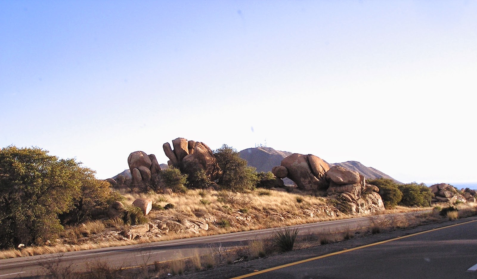
few and far between, so to go east we had to take I-10 passing
through Texas Canyon, breathtaking piles of enormous rocks spewed
from a volcano a long long time ago. It is extremely difficult to
keep your eyes and thoughts on driving when surrounded by such
natural beauty.
 |
| I-10 driving through Texas Canyon, between Benson and Willcox, Arizona |
Next
up the road was Willcox, the home of Rex Allen, “The Arizona
Cowboy”, and a wonderful small museum devoted to him. He was one
of the four singing cowboys along with Gene Autry, Roy Rogers, and
Tex Ritter. You could always recognize them – cause they were the
ones in the WHITE HATS!! While in Willcox we just had to have lunch
in a converted railroad car for some really great BBQ and then we
took the “Roller Coaster Highway” south out of Willcox to the
Chiricahua National Monument through some incredible countryside.
 |
| Rex Allen Monument in Willcox, Arizona |
 |
| Mural |
 |
| Some of Rex Allen's costumes in the Rex Allen Museum. |
 |
| some of their numerous original movie posters |
Entering
Chiricahua National Monument we were greeted by a band (eight - Mom,
Pop, and the Kiddies) of coatimundi crossing the road, taking their
own sweet time chasing each other in circles and chittering at each
other. Quite a pleasant surprise. Coatimundi are South American
mammals that have migrated north and are related to raccoons and look
like a cross between the raccoon and an anteater. The Park surprised
us with some of the most unusual rock formations we have thus far
seen on our voyage. We hiked a couple of trails in, over, around,
and through the formations for even more spectacular views.
 |
| Chiricahua National Monument, Arizona |
 |
| beautiful rock formations |
 |
| The coatimundi were playing on and crossing the road as they chattered away......what a delightful surprise! |
 |
| so many balancing rocks |
 |
| The farthest ridge is called Cochise's Head, for obvious reasons. |
 |
| These rock formations look like armies of marching men |
 |
| Jim named this one a dog with a back pack - I like it! |
 |
| a balancing Dove perhaps.. |
 |
| just .... WOW!...this was over our heads alongside the trail we were on |
 |
| How are some of these holding on? |
 |
| Jim and I named this group - a frog on the left, a sheep in the middle, and an ice skate on the right. |
On
the way back home we passed the Willcox Playa. Man o man the
different things to see out west never cease to impress us. The
Playa is an enormous sandy area devoid of any vegetation with the
wind blowing across 24/7. It is a dry ancient lake bed. (Don't
forget the Visene!) Blowing sand can be seen for miles, rising high
into the air and almost blocking views of the mountain range they
were near. It is a triangular 8 x 10 mile area easily seen by
astronauts and cosmonauts, who reportedly use it as a landmark. Dust
storms can rise up in an instant and summer temperatures can hover
around 135 degrees. Again, fascinating!
 |
| the beautiful ribbon of road.... |
 |
| dust blowing along the Willcox Playa |
 |
| the barren Willcox Playa |
Next,
it was off to Tombstone for our second visit, home of the gunfight at
the OK Corral. Can you believe something that lasted less than 30
seconds has spawned 11 films and two TV series?! Not to mention the
ongoing controversy regarding the accuracy of the details. We took
in the gunfight, had lunch at the Crystal Palace where all female
employees wear bustiers (sorry no pics, Julie couldn't find the
camera), did some “cowboy” shopping, and then went underground,
under the town, for a great walking tour of the Tombstone
Consolidated Silver Mine after Julie the “Hat Queen” donned her
latest quest for millinery fashion prowess.
 |
| The Good Enough Silver Mine in Tombstone |
 |
| old wooden supports inside the mine |
Our
next foray into the desert areas surrounding Benson took us down a
“Scenic Byway” from Tombstone to Nogales (USA). We saw Nogales,
Mexico across a great valley but being of the not too brave
persuasion, we decided to take pictures (and not drive) across that
valley of “the fence” separating “us” from “them”!
 |
| The fence along the border between Nogales, Az and Nogales, Sonora |
This
trip provided us our first Arizona Ghost Town that actually still had
some buildings. We took in Fairbanks, AZ, a town built for a
stamping mill on the San Pedro River to process the silver ore mined
in Tombstone. As with most of the towns out here in the Southwest,
they usually have had an identity crisis. Originally the location of
a Native American village known as Santa Cruz in the 18th century,
next this town became known as Junction City, then it was called
Kendall, and finally in 1881 when a railroad needed to be built from
Tombstone, a Chicago investor named NK Fairbank chipped in some big
bucks and in his honor the town became Fairbank. Now wasn't that
nice! When the mines in Tombstone flooded in 1886, and the silver
mining process slowed down, Fairbank's importance dwindled. But in
1889 copper was discovered in Bisbee and the railroad through town
was in need again. In 1901 the Boquillas Land and Cattle Company
bought up all the land around including the town and actually kept
the US Post Office operating until 1970, when the very last of the
residents finally moved on. This town was actually quite interesting
investigating the buildings that are left. Most of the “ghost
towns” are nothing more than a few adobe bricks lying on the ground
where “something” used to be!!
 |
| An abandoned homestead in Fairbanks |
 |
| What had been the commercial buildings in Fairbanks |
 |
| One of the many signs in the ghost town, explaining what we were seeing and what had been there before. |
Since
we were on the subject of rocks! Julie got a turquoise (rock) ring a
few years ago while in New Mexico that needed to be sized down.
Knowing there was a jeweler in Tubac capable of working with
turquoise we headed towards there. Along the way we came to
Tumacacori National Historical Park, so naturally we turned in. It is a Spanish Mission originally built in 1757 by Spanish Jesuits. Quite a few of the buildings
are still there and in remarkable condition for their age. We toured
the mission, took lots of pics and then proceeded on north to Tubac
where Julie got her rock fixed!!
 |
| Tumacacori Mission |
 |
| weathered facade of the Mission |
 |
| A small very old graveyard inside the walls of the Mission |
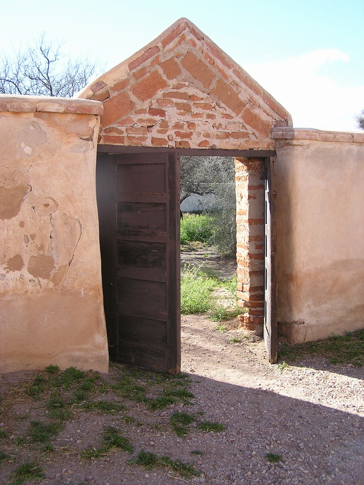 |
| An old gate in the Mission wall |
 |
| What historians propose the Mission looked like inside centuries ago. |
 |
| The beautiful Santa Rita Mountain Range near the Tumacacori Ruins |
Well,
we were supposed to be gone from Benson today, but our mail package
did not arrive yesterday as expected, and the Benson Post Office
isn't open on Saturdays. So today we took the day to explore more of
Cochise County, and we were certainly not disappointed. We got up
early and drove down to Bisbee to take the Queen Copper Mine tour,
and do a little sightseeing in Lowell, AZ. Lowell is a small town,
found in the Arizona ghost town website, at the bottom of the hill
and across the “Lavender Pit Mine, south of Bisbee”. One street
is entirely devoted to old buildings and vintage cars, trucks, and an
old police station. It is like a museum, a real step back in time.
 |
| Lowell, Az, next to Bisbee |
 |
| the beautiful colors of the soils around Bisbee |
For
the Copper Mine Tour Julie once again donned the garb and became a
walking fashion show. The tour involved straddling a mining car
pulled by a mule (no not the corn eatin kind) riding the rails 1500
feet into and 400 feet down into the mine. The tour guides are all
former “Queen” miners who are some of the most knowledgeable
docents we have encountered.
 |
| Riding into the entrance to Bisbee's Queen Copper Mine |
 |
| one of the original rock carts |
 |
| notice the many shims!!!!!! |
Following
the tour we drove “on down” to Naco, a border town with “the
fence” running right down the middle. We drove around town
approaching “the fence” from all different angles. It really is
quite a daunting presence on the landscape in this part of the state.
We continued along the border heading west and took in the Coronado
National Monument. We took a little drive up the Montezuma Canyon
and then continued up the mountain to the Montezuma Pass Overlook.
Incredible views, and once we stopped Julie opened her eyes and pried
her fingers form the hand hold. You see this little “side trip”
(ie: steep gravel road up the side of the mountain, with very tight
switch backs and straight-down drop offs) is one of those roads I
love, and Julie endures.
 |
| Border fence along the border at Naco, Az. |
 |
| A double length of fence where a Border patrol truck was parked in between, watching. |
 |
| Coronado National Memorial, south of Sierra, Az. |
 |
| the white knuckle portion of the road for me |
 |
| The winding, ascending road heading up to the pass from the Visitor Center |
 |
| Notice the long line of the border fence going off to the east in the distant valley |
That's
it for now. More Arizona adventures to follow soon.
.


I so enjoy all your photos and narration! You do a wonderful job! We are seeing we should have spent an extra 10 days there!
ReplyDeleteOne of the best parts of our trip was meeting you!!
Oh.... and I think you should link this to your FB page too!
ReplyDeleteTerrific post! We have been to many of the same places but I can tell we missed some good ones. We will get back to that area someday. Happy trails!
ReplyDelete